Python GIS - NDVI From Landsat Satellite Image (GDAL) HD
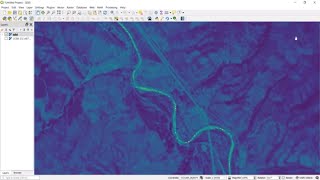
Use the GDAL Python API in QGIS to calculate the NDVI (normalized difference vegetation index) from a Landsat 8 satellite image. We will create functions to handle opening and creating rasters and doing raster calculations. This will abstract your code so that it can be reused for other operations and makes it easy to batch process many different operations. Visit opensourceoptions.com for more content and courses ⭐ Kite is a free AI-powered coding assistant that will help you code faster and smarter. The Kite plugin integrates with all the top editors and IDEs to give you smart completions and documentation while you’re typing. https://www.kite.com/get-kite/?utm_medium=referral&utm_source=youtube&utm_campaign=opensourceoptions&utm_content=description-only
 HD
HD HD
HD HD
HD HD
HD HD
HD HD
HD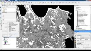 HD
HD HD
HD HD
HD HD
HD