videose
Главная
Displaying
thumbs
Image to image georeferencing in QGIS 3.4
HD
youtube
25.11.2018
This video shows how to perform an image to image georeferencing of a scanned map. The Ground Control Points are taken from a reference Google Satellite image from the QuickMapServices plugin in QGIS.
Похожие
видео
HD
25.11.2018
06:41
Image to image georeferencing in QGIS 3.4
youtube
HD
19.01.2019
15:33
Slope & Aspect modelling in QGIS 3.4
youtube
HD
14.08.2018
10:22
Georeferencing in QGIS 3 | burdGIS
youtube
HD
04.03.2017
13:21
ME315 Ch2-8 | المسائل الشاملة ح3 | Review Problem 2-32 | part 3 of 3
youtube
HD
04.03.2017
15:30
ME315 Ch2-7 | المسائل الشاملة ح2 | Review Problem 2-32 | part 2 of 3
youtube
HD
03.03.2017
21:45
ME315 Ch2-6 |المسائل الشاملة ح1| Review Problem 2-32 | Part 1 of 3
youtube
27.10.2018
02:34
Azur Lane | "Farm" How to get Akagi in stage 3 - 4 Hard mode | Akagi & Kaga
youtube
HD
07.05.2018
18:40
Downloading and preprocessing Sentinel 2 images using the Semi-Classification Plugin in QGIS 3.0
youtube
HD
08.08.2018
26:07
Flood Monitoring Tutorial with Sentinel 2 and Landsat 8 Images in QGIS 3
youtube
HD
24.03.2018
04:06
QGIS Tutorial | Grundkarten in QGIS 3 einfügen | Deutsch | German
youtube
HD
05.02.2019
12:12
Editing in QGIS 3.4 – Mapping in GIS
youtube
HD
20.03.2018
06:06
How to add a Google Map/Terrain/Satellite Layer in QGIS 3 - Tutorial
youtube
HD
30.10.2016
04:16
QGIS 2.18: Tile server (XYZ) anche in QGIS 3.0
youtube
20.05.2022
56:36
New 3D and point cloud features in QGIS 3.26
youtube
HD
13.07.2018
11:16
How to visualize water quality data in QGIS 3? From points to raster to contour lines - Tutorial
youtube
15.09.2018
02:25
How to Create DEM and Elevation Profile in QGIS 3
youtube
22.02.2018
04:50
Digital Elevation Model (DEM) 3D Visualization in QGIS 3.0
youtube
HD
16.06.2020
10:28
MapTiler and vector tiles in QGIS 3 | burdGIS
youtube
HD
01.12.2017
08:30
Exploring the 3D Viewer in QGIS 3.0
youtube
HD
06.01.2016
08:57
Bootstrap Image Background - CSS3 Background Image and Positioning
youtube
HD
27.10.2019
41:18
QGIS User 0020 - New features in QGIS 3.10
youtube
HD
27.11.2017
15:56
Working with SpatiaLite data in QGIS 3.0
youtube
HD
24.12.2018
05:41
How to Install Third-party Python Modules in QGIS 3.x
youtube
HD
28.08.2018
19:29
Styling vector layers in QGIS 3
youtube
HD
02.01.2022
08:49
How To BOOST FPS in Chapter 3! (Get MAX FPS in Fortnite Without Any Tools!)
youtube
HD
06.09.2019
23:34
Mapping Crime Data in QGIS 3 - Two ways to map hotspots
youtube
HD
14.02.2019
17:39
Calculate percentage of land use per subcatchment in QGIS 3
youtube
HD
17.08.2018
14:45
Load spreadsheets in QGIS 3, join and interpolate
youtube
HD
18.05.2017
01:44
D3 like plots in QGIS 3
youtube
HD
27.12.2017
05:53
How To Load HTML File In WebView In Swift 4 Xcode 9 ( Hindi )
youtube
HD
27.03.2018
16:41
Reports in QGIS 3.0
youtube
HD
17.03.2020
03:53
КАК УБРАТЬ ЛАГИ И ПОВЫСИТЬ ФПС В Battlefield 3
youtube
Показать еще
 HD
HD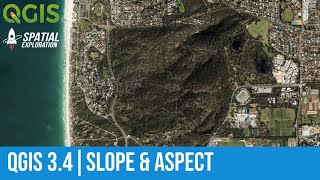 HD
HD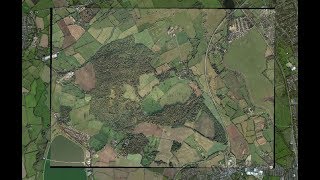 HD
HD HD
HD HD
HD HD
HD
 HD
HD HD
HD HD
HD HD
HD HD
HD HD
HD
 HD
HD

 HD
HD HD
HD HD
HD HD
HD HD
HD HD
HD HD
HD HD
HD HD
HD HD
HD HD
HD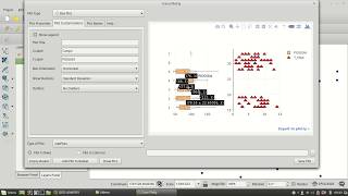 HD
HD HD
HD HD
HD HD
HD