Learning Modern Surveying Instruments - DGPS (POST PROCESSING in LEICA GEO OFFICE) HD
Surveying is the technique, profession, and science of determining the terrestrial or three-dimensional position of points and the distances and angles between them. (Thank You WIKI) In this modern era, the data should be accurate and precise. This DGPS gives exact Latitude and Longitude of the point required. Now the data acquired in DGPS should be processed for its further use in practical applications like Analysis, Design, Forecasting, Total Station and So on.. The data of DGPS is processed in Leica Geo Office. Leica Geo office can process the data automatically and give us the exact latitude and longitude of points in WGCS as well as UTM Co-ordinates. Wanna Know More about it, Please Check out the Whole Video!! And Also thinking How to apply the data from the Survey using DGPS in Total Station, than do watch our next Video Regarding the same!! :) The Steps for importing the data, processing it and generating the report is shown in this video. Please Listen and understand carefully. For any Query and Doubts, contact us on gecbvn.civil@gmail.com Regards, Team Sonpari Prof. Y.P. Pathak (Beloved Guide) Vivek Solanki Digvijay Solanki Bhavik Shah Yash Shah Kartik Hingol
Похожие видео
 HD
HD
 HD
HD HD
HD HD
HD HD
HD HD
HD

 HD
HD HD
HD HD
HD HD
HD HD
HD
 HD
HD HD
HD HD
HD HD
HD HD
HD HD
HD HD
HD HD
HD HD
HD HD
HD HD
HD HD
HD HD
HD
 HD
HD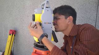 HD
HD HD
HDПоказать еще