CAD Import for Cross Section Drawing HD
http://esurveying.net/land-survey/importing-cross-section-data-from-cad CAD Import for Cross Section Drawing Welcome to video tutorial on how to import cross section levels from CAD drawing to ESurvey CADD. This process involves 5 easy steps a) Mark Chainages along the Alignment b) Create offset lines and move entities to specific layers c) Interpolate the values d) Export values from CAD drawing e) Import values in ESurvey CADD Mark Chain ages along the alignment (MCH) In road, railway and canal projects cross sections are created at fixed distances, say 30M and the area computation is done in these cross sections and then the volume is computed depending on area. Normally survey is also done at those fixed distances only. However, it is not possible to Exactly survey on the points at those distances and their respective offsets. Using ESurvey CADD Interpolation module interpolating the values is easy. Type ‘MCH’ (Mark Chainages) at the command prompts. A window will appear expecting inputs like Prefix, Suffix, Starting Chainage, Increment Etc. Please specify Cross Section Interval in Increment and Cross section line length as per the project requirement. Click on Ok, and then select the alignment. You may not that program will create cross section lines (that is Chainages) along the alignment. Depending on the input values Label indicating the Cross Section value is also marked. Create offset lines and move entities to specific layers For interpolating multiple values, ESurvey CADD expects layerisation of Text and lines. All the cross section lines need to be in ‘CS’ layer. Central line that is alignment line needs to be in LS layer. You can offset the center line on either side depending on offsets at which you want to interpolate the values. In this example, you can note that the centerline is offset at distances 2, 4, 7 and 10 on either side. These offset lines to be present in “Offset” Layer. Elevation texts representing the surface should be in ‘Elev’ layer. Once the text and lines are in ‘LS’, ‘Elev’, ‘Offset’ and ‘Elev’ layer, you are ready to interpolate values in bulk. C) Interpolate the Values Interpolation along the alignment can be done with ‘ITI’ or ‘IDI’ command. To interpolate the values with ITI command elevation needs to be in Elev layer and ESurvey CADD will interpolate the values at all the intersections of the CS line with an offset and LS layer. It is advisable that only the levels to be considered for interpolation shall be in the Elev layer. In case of IDI Command, LS and offset lines need to be 3D lines and IDI command will interpolate at the intersection point of all the LS and offset lines. You may note that all the interpolated values will get created in a layer named ‘Layer1’. In case of ITI command if the intersection point is outside the surface created using the levels in Elev layers, software will create the levels in layer named ‘Layer2’ which will help you to make out that levels interpolated are outside th
 HD
HD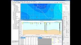 HD
HD HD
HD HD
HD HD
HD HD
HD HD
HD HD
HD HD
HD HD
HD HD
HD HD
HD HD
HD HD
HD HD
HD HD
HD HD
HD HD
HD
 HD
HD HD
HD HD
HD HD
HD HD
HD HD
HD HD
HD HD
HD HD
HD HD
HD